Rapid Ecological Assessments
Written By Dan Suthers
This article is the third in a series of features on data gathering methodologies used on the NWHI RAMP 2004 expedition. In this article, I present the reader with the research challenge to be solved and describe the Rapid Ecological Assessment in detail. I conclude by summarizing major discoveries that have been based on this method, and speculating about how school children might conduct similar investigations in reef or terrestrial environments. Sources include [2,3,4], and conversations with Greta Aeby, Ranya Henson, Randy Kosaki, Peter Vroom and other team members.
The Challenge
Here is your challenge. You are planning an expedition to study one of the last remaining undisturbed reef ecosystems on Earth. Your objective is to describe the ecosystem in terms of the occurrence and abundance of species in all major taxonomic groups (fish, algae, corals, and other invertebrates), and to do so quantitatively (with numbers, not just words, which can be imprecise). Such a description is important because the undisturbed reefs provide natural baselines for monitoring and management of the region, and for comparison to disturbed reef ecosystems elsewhere.
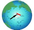
However, you must do this under some difficult constraints [3]. Due to the remoteness of the region in which the reef ecosystems occur, the scientific party must go up there by ship, which is very expensive. Only one or two trips will be possible per year. To reduce the danger to ship and divers and for better visibility during underwater observations, the expeditions will be conducted only during the relatively calm season of August through October. You need to send specialists in multiple areas of study, including fish, algae, coral and invertebrate biologists, as well as oceanographers and support staff. However, bunk space on the ship is limited.
Site selection is difficult because you need to find sites around each island or atoll that satisfy the needs of all of these specialists, sometimes with tradeoffs. You can't spend much time in one place, because there are 10 geographically separated islands and atolls to be visited during the 5 week expedition, and each island or atoll must be observed at many locations to characterize its many habitats. Forereef, backreef and lagoonal/patch reef habitats should be examined, with 3 locations of each type sampled to be able to generalize the observations.
The time at each site is also limited by safe diving practices: each diver can dive a maximum of three dives up to 1 hour per dive. Also, the ship cannot directly approach the study sites (the water is too shallow), and can carry only a limited number of small boats for this purpose: three or four launches can be out at a time.
How would you organize the work of the expedition scientists to meet your objectives under these constraints?
This question has been faced by each of the Reef Assessment and Monitoring Program expeditions that went to the NWHI beginning in the summer of 2000. The solution has been refined over these years.
Three Teams
Previous articles on this site have already described parts of the solution. In order to characterize the physical environment in which the reef ecosystem exists, an oceanography team is allocated one of the boat launches for daytime operations in which direct measurements of water parameters are taken and various sensors are deployed to gather data during the year. Personnel for these operations can take 3-4 berths. To maximize ship use, other oceanographers conduct night operations in which various sensors are deployed as the ship follows designated tracks in deeper water locations, without having to worry about the positioning required for daytime boat launches and retrievals. At least two berths are needed for this team.
A "big picture" of the reef life is obtained by a team that conducts towed diver surveys. They need another one of the boat launches, and will take four berths (we need fish and benthic specialists, and dive limits as well as the needs for a boat driver require that they take turns diving). Yet, as valuable as they are in obtaining rapid coverage of large areas (about 2km transects per each of 4-5 tows/day), towed diver surveys do not provide adequate descriptive detail at the species level.
The remaining problem faced by scientists is to obtain a detailed and accurate description of all the organisms that co-occur in specific yet representative reef locations, and to do so as quickly as possible. This is the job of the Rapid Ecological Assessment (REA) team, which is really a team of teams. The REA team includes fish, algae, coral, invertebrate biologists (coral is also an invertebrate, but given special treatment). All of these people need to gather data at the same location to enable study and understanding of the interactions between species of different taxonomic groups that co-occur in a location. Furthermore, the data must be gathered at the same time so that organisms that occur together are observed (different organisms might be present at different times of day). The work must usually be completed in one visit to the location due to time constraints and the availability of only one boat to transport the scientists. How do we organize the work of all these people at the same location?
General Strategy of an REA
A little thought suggests some features that our procedure should have. The divers (8 divers on this expedition's REA team) can't all be in the same place at the same time, but we want as many of them working at the same time as possible. We want to sample a "slice" of the reef ecosystem, so that we get a more representative sample than if we looked at a single point. Both of these considerations suggest that the REA be conducted along a transect (line) that provides a representative sample while allowing divers to spread out, taking turns gathering data along the transect. Another consideration is the mobility of some of the species being studied. Some fish will swim away when approached by a diver, while others will approach and even mob a diver, so the fish population must be observed by the first diver to enter an area. Therefore the scientists studying fish should go first along the transect. Finally, fish scientists need to cover more ground than those studying small immobile organisms, so may conduct more transects than the other scientists.
These considerations give us the basic structure of the REA: the fish team dives first, and observes fish in the area before the fish assemblage is disturbed. The fish team also lays out a physical line marking the observation path followed by the other divers. Then teams studying less mobile species will follow, examining the benthic habitat in detail. The fish team will conduct observations along three 25 meter transects, but the others will follow on only the first two of these.
Each of the survey teams needs to collect a permanent objective record of their target species and the environment in which they occur. This requirement is met well by photographic or video recording along the transect line. However, photographic and visual images can be time consuming to analyze, and it may be more difficult to identify specimens to the species level from an image than it is in the field. Preliminary results (before analysis of the images can be undertaken) are also useful for planning opportunistic follow-up observations where merited, and also for reporting purposes. Therefore, in addition to recording images, the scientists note on waterproof paper the species they observe. They also need to ensure that no significant findings are missed due to being outside of the prescribed range of the camera. Each team conducts exploratory investigation of the surrounding environment and collect samples as needed after the formal recording is done. These considerations as well as others specific to the needs of each team lead to team-specific protocols, as described below.
Fish Team
 The fish team consists of three divers. Two of the divers lay out the 25 meter transect line while recording counts of fish species of size greater than 20 cm within 4 meters of each size of the line, as these are the fish likely to scatter greater distances. The divers then swim back along the transect recording fish smaller than 20cm witin 2 meters of the line. [1,2]. The procedure is repeated twice for a total of three transect lines, ech starting about 5m from the end of the previous line. Upon completion of all three transects, they swim over the reef to record rare species and make any photographs deemed necessary. On the NWHI RAMP 2004 REAs I observed, Craig Musburger and Darla White were the fish divers playing this role and shown in the accompanying pictures.
A third diver is responsible for conducting "stationary point counts" (SPC) of large fish away from the transect line. This diver swims to points at least 10 meters away from the transect, and conducts a 360 degree scan to record fish greater than 25cm in size within a 10m radius for 5 minutes. Four SPCs are conducted at each site. On the REAs I observed, Randy Kosaki filled this role.
The data gathered by the fish team (as well as that gathered by the towboard team) can be used to estimate fish biomass by a formula that converts length to weight (W = aLb where a and b are constants; see [1]). Given the weight of a fish and the number of fish in each weight category observed in a 100 (25 x 4) meter area, one can easily compute the density of fish biomass per a given area of reef. This number is an excellent representation of the "productivity" of a reef in terms of how much fish life it supports. The data is used in other ways as well.
Coral, algae, and invertebrate teams follow the fish team about 15 to 20 minutes later, so as not to crowd the transect with divers, and to enable fish observations before the fish leave.
Coral Team
Over several expeditions, coral biologists have developed protocols that require two coral specialist divers [3].
One biologist, Jean Kenyon on the current expedition, videotapes the transect line with a downwards-facing camera to document the reef substrate. A 360 degree video is taken at the start of the transect line to record overall reef structure. The video record provides a permanent visual record, but for more immediate results and the greater accuracy of in-situ observation, the specialist then returns along the transect, recording the genus or species if possible of each coral colony falling within 1m of the line and assigning the colony to a category according to its size. The number of colonies with bleached tissue is also tallied. In addition, the relative abundance of each species is estimated in a 25m wide zone around the transect lines, using a 5 point scale. Representative coral samples are collected as needed for species identification.
A second biologist, Greta Aeby on the current expedition, examines corals along a 6m wide swath of the 25m transect, looking for signs of disease, predation, or bleaching. All such instances are photographed and tallied and described on a data sheet. Samples are also taken as judged necessary. If time permits, this data will also be collected along a second transect line.
Additional work may be done to address specific research questions that support conservation and management decisions. For example, this year Jean is collecting samples for studies of algae symbiosis and coral distribution being undertaken in collaboration with other researchers.
Algae Team
 The algae team studies benthic macroalgae: algae that grows on the bottom and is big enough to see. Instead of a video record, this team uses a photoqradrat method developed and validated by Preskitt, Vroom & Smith [4]. The transect requires a two-person team. One person operates the camera, which is mounted on frame constructed from PVC pipe to ensure that each image is a standard distance from its subject and covers a standard area (see illustration). The camera operator need not be trained in the identifcation of algae, an advantage when insufficient trained specialists are available. The photoquadrats are taken at random locations along the transect line: a series of random numbers were generated before the trip, and are used to determine the locations (defined by meter marks) at which photographs and samples are taken. Randomization enables statistical generalization to the area from a few samples.
As is the case with the other teams, the algae team also takes notes on the species seen. This task is carried out by the second team member, who must be a phycologist (algae specialist). Phycologists have a more difficult species identification task than other specialists. Many algae can only be identified to the species level through microscopic examination of cell structures. Although our phycologist, Peter Vroom, is sufficiently familiar with the NWHI to identify most algae in the field, samples are also required by his discipline's practices. Phycologists are a type of botanist, and botany has strict rules about species identification. Therefore the algae team collects samples from within the photoquadrat for later analysis and preservation. Visual inspection and sampling is also important to deal with the "canopy" effect: algae or other organisms growing above the surface may obscure others growing below them.
 After completing the photoquadrats, the algae team examines the surrounding area to look for any species they may have missed. On our expedition, Peter Vroom is the lead phycologist, and Erin Looney is the phycologist in training and camera operator.
Invertebrate Team
The invertebrate team in our expedition consists of one person, Ranya Henson, who is working on behalf of Scott Godwin (not on the expedition). Ranya uses a PVC pipe square that she places at predetermined random locations along the transect to count percent coverage of invertebrates. She also swims along the 25 meter transect and tallies the macroinvertebrates visible within a 2 meter wide swath. Like the others, she also examines the area to look for unusual specimens outside of the sample quadrats. All data is recorded on paper.
There are typically a large number of very small invertebrates hidden below the surface and living inside corals and other substrate material. Identification of these invertebrates would require collecting substrate samples from all of the locations and taking them back to the wet lab on the Hi`ialakai for processing. This was actually done on previous expeditions, but is very time consuming, and the specimens must usually be taken back to the researchers' home institutions and even forwarded to taxonomic experts throughout the world for full identification. Before the expedition, Scott Godwin told me that they have a huge backlog of samples to be identified from previous expeditions, but he felt it was important to have someone on this expedition as well to monitor invertebrate populations and watch for unusual specimens.
What Scientists Are Learning
The REA work has been underway for only a few years, yet much has been learned about the NWHI reef communities, and some new discoveries have been made. For example, Friedlander and DeMartini [1] found dramatic differences between reef fish populations between the NWHI and main Hawaiian Islands. Maragos et al [3] report data from a single expedition that nearly doubled the number of stony coral species known to occur in the NWHI, and documented high levels of endemism: 30% of the NWHI coral species occur nowhere else in the world. Peter Vroom has identified three algae species previously unknown to science (Acrosymphyton brainardii [5], Scinaia huismanii [6], and Dasya atropurpursa [in press]). (Acrosymphyton brainardii was named after Rusty Brainard, who made many of the NWHI scientific expeditions possible.) Furthermore, Peter and his collegues have found that healthy reef ecosystems in the NWHI are dominated by algae rather than coral, challenging a commonly held assumption that algae dominance is a sign of deteriorating reef health [Vroom, Page, Kenyon & Brainard, paper under review].
In the first few years of study the main objective of the REAs is to gather as much information as possible and answer discipline-specific questions. Scientists from each discipline have written papers in their own specialty, yet over time the aim is to support comprehensive ecosystem research by combining data from the REA teams.
Can Children Do REAs?
Allow me to speculate about the potential value of a multidisciplinary team approach to REAs in secondary and perhaps even primary school education. Learning by doing is an important strategy in education. Children will be motivated to learn, remember more and develop real skills if they conduct an activity themselves rather than merely reading about it. Can children learn about field science by doing REAs?
Clearly, SCUBA diving is out of the question, and some school administrators may even elect to disallow snorkeling expeditions on school time for liability reasons. However, I suggest that a similar methodology might be applied to terrestrial science, with similar benefits.
If snorkeling expeditions were allowed, one can imagine having a class divide into specialists--the algae, coral, fish and invertebrate teams--and having them survey a nearby shallow water reef using techniques similar to those described above. An investment in waterproof paper or other means of taking notes in the water will be necessary, although underwater cameras will probably not be within the financial means of the school. The protocol can be similar: the fish team swims out a line and tallies fish along the way; then the other three teams follow, laying down square frames at random locations along the line and counting what they see inside the squares. (Similar techniques have been applied at Honoka`a school, where children studied brackish water shrimp.) The data sheets can then be entered into computers at the school. Data can be compared between sites. If the school can visit only one site, data can be compared to published data from the NWHI, providing children with an appreciation of the differences between reef communities between the main and northwestern islands [1]. Also, if such a project is maintained over several years, children can compare their data to dta gathered by the previous year's class. Perhaps many of the older children will still be in the same school, and will be able to mentor the younger children and help with the comparison. The experience provides abundant opportunities for learning on a variety of topics ranging from data sampling and analysis to conservation issues.
For a terrestrial REA, imagine a team with bird and mammal specialists that enter an area first, tallying these mobile species, followed by plant and insect specialists, and perhaps (in analogy to oceanographers) others who measure the physical characteristics of the environment such as temperature, soil Ph, and perhaps rainfall with gauges previously deployed. As with reef REAs, children can learn about their respective organisms in advance, and can compare results across ecosystems and over the years.
If you are a Hawai`i teacher interested in these ideas, email the author at contact@hnlc.org and/or join a community of like-minded teachers at hnlc.org.
[1] Friedlander & DeMartini (2002)
[2] Maragos & Gulko (2002)
[3] Maragos, Potts, Aeby, Gulko, Kenyon, Siciliano & VanRavenswaay (2004)
[4] Preskitt, Vroom & Smith (2004)
[5] Vroom & Abbott (2004a)
[6] Vroom & Abbott (2004b)
See also these related NOWRAMP 2002 features:
Real Science - the science behind the NOWRAMP Expeditions by Mark Heckman
Rapid Ecological Assessments by Mark Heckman