NOWRAMP
2002
Real
Science
Posted by Mark Heckman, Educator, Waikiki Aquarium/ University
of Hawai’i – Manoa
My
definition of science is simple, “science is the search
for verifiable reality”.
By
this I mean that it is the same for you, me, or someone
from a different country that does not speak the same
language or even think in the same fashion. Science
gives us common ground to work from. An apple is an apple
is an apple – no matter what we call it. If I put one
apple on a table, and I say, “here is one, 4 inch apple”,
it will be hard for anyone to disagree on that basic information.
Each observer can measure and count that apple and come
up with the same result.
Then
we can decide what to do. If we know how many apples there
on that table and how large, what kind they are and so on;
we can make reasonable decisions about them. If someone
takes one, we will know. Perhaps we all want to eat the
apples; but then we would have no more. Perhaps we will
want to save them for tomorrow, or plant the seeds for future
generations.
The
Northwestern
Hawaiian Islands are still a largely unknown
wilderness. When we try and talk about them, everyone tends
to have their own impressions and ideas. We need some basic
facts. We need the science. How many fish are there? How
big are they? Is the bottom mostly sand, reef, or rock?
What is so special about the place and why should it be
protected for us and our children? With science, we can
at least start with some common ground.
To
do this, the NOWRAMP 2002 has assembled a diverse
group of experts working on a variety of projects.
To learn more about these projects, click on the highlighted
words below.
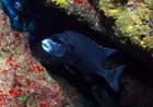
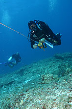 REAs
(Rapid Ecological Assessments)
REAs
(Rapid Ecological Assessments)
Would you like to dive in uncharted waters? Think about
being part of an REA
team. These divers do three work dives a day trying
to get a grip on the basic ecology of the reefs by evaluating
the fish, corals, invertebrates, and seaweeds (algae). At
night they just have time to enter their data and process
their specimens, before falling into bed before another
full day. Typical work days on the boat are from 6:30 am
– midnight.
Towboards
Is swimming is too slow for you? Towboards (NOWRAMP
2000 Preliminary Findings Report (PDF file, 2.6 MB)
) allow a fast survey over a much greater distance per dive
in a variety of habitats. Two divers with video cameras
mounted on towboards are pulled behind a boat. The divers
maintain distance of one meter above the reef. Towboards
cover large amounts of territory and help locate areas that
need further study.
Multispectral
Imagery
Just how good and how useful are satellite images? Our multi-spectral
and satellite imagery group has to go diving too. The word
here is “ground-truthing”.
Images taken by satellite or special cameras need to be
verified or corrected by divers who match various features
seen via the remote sensing devices with the actual features
found underwater.
Coral
Cores
As they grow, corals lay down layers of skeleton like tree
rings that can tell us quite a bit about the past. How fast
has the reef been growing? Is it slowing down now or actually
accreting faster? We really don’t know. A coral
core gives us a snapshot of the past history of
a reef and better ideas about what the future has in store.
Permanent
Transects
Rapid Ecological Assessments give one kind of information.
Permanent transects (lines) that
can be checked for future changes, year after year; give
another equally important type of information.
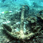 Maritime
Archeology
Maritime
Archeology
Maritime cultural resources (Laysan
Shore Survey), are important as well. Locating shipwrecks
(A
New Submerged Site at Laysan), anchors (The
Footprints of Ships: Notes About Anchors), and other
maritime artifacts give us information of the history of
an area. Maritime archeology (On
Finding Wrecks ) helps us understand
it in a more complete fashion.
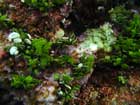
Terrestrial
Ecology
These tiny islands and atolls are intimately linked to the
sea. The beaches and land areas are filled with the calls
of nesting shorebirds and seabirds (The
Value of Tranquility). Green sea turtles (The
Language of the Sea) haul out on the beaches to
bask and nest. Monk seals (The
Language of the Sea) have their pups here. Native
plants (Loulu:
The Giving Seed ) flourish if given a chance. Terrestrial
work is just as important as the marine surveys.
Education,
Media and Documentation
If we do not share the information, no one knows it exists
and we might as well never have been here. Our Education
team works to get the information out to school groups (Video
Clips) and the general public (Counting
Sharks). Many of the articles and videos on the
web site are from various parts of our education team. Scientists
will also write reports for other scientists.
The Media (News)
group reaches an even larger audience with short but vital
announcements. Keeping photo, video and written images of
all that is done on a research cruise is also critical.
Images, video, written accounts by the Documentation (NOWRAMP
2002) group and research data collected by the science
teams on the cruise will be available to all to view and
use to understand just how special these islands really
are.
Hot
Links:
How many languages can you say “apple”
in? On our boat, we came up with “mela” (Italian),
“ciao” (Nepalese), “manzana” (Spanish),
“rlingo” (Japanese), “apfel” (German),
“pomme” (French), or in the international language
of science, “fruit of a tree in the genus Prunus.”
<<back
(2)
To REA page (Education/Day 15/feat_rea_091502)
Remote Sensing
Satellite images of reefs can assist in management of coral
reefs. Varying types of reef, coral, algae, sand, and soft
mud bottoms reflect light differently. Specialized satellite
images capture these differences and group them by type.
On the ground teams then need to calibrate or make sense
of the spectral groupings, categorizing the light wavelengths
reflected back to the satellite with reality in the field.
To do this, teams first take pictures in the field with
cameras that capture wavelengths similar to what the satellites
are gathering. The field teams build a “library”
of information that relates reflectance to a particular
reef type, such as coral cover, sand cover, mud, rubble
and so on, to reflected wavelengths. Depth and clarity of
water plays a part here as well. Once the library is built,
the information is fed back into the satellite data to make
the first round of maps.
The
first round of maps are taken back into the field for “groundtruthing”.
It is critical to check the maps with reality and see if
the information fed back into the mapping process is accurately
portraying the situation on the reef. This is time consuming
initially, but will pay off in the end with better and better
maps.
<<back
Coral Cores
Some corals may live for hundreds of years. At Kure Atoll
(9/26/02) the coring/monitoring tean found a living finger
coral colony that was 33 feet across and 10 feet high that
must be hundreds of years old. Within their skeletons corals
carry vital information of the history (and possible future)
of the reef. Part of this information is available through
the skeletal growth bands. As corals grow, they periodically
put down a new base layer of calcium carbonate. This layer
may be laid down seasonally or more often.
Coral scientists can read these bands and gain a large amount
of information from them. Historic growth rates become available.
These show not only what the average growth rate of a coral
and its part of reef building or accretion is; but can also
give information as to when the rate increased or decreased.
Rates of growth and reef accretion are vital to help us
understand the response of reefs to environmental conditions
such as water temperature, light, and ocean chemistry.
<<back
Permanent Transects
Along with all of their other duties, the Coral team has
been averaging one new permanent transect per day this trip.
Stainless steel stakes are pounded and expoxied into the
bottom to create a permanent 50 meter long study site. Once
in place, high quality photo images are taken continuously
along this transect, covering a minimum of one meter of
substrate along the line.
Permanent
transects provide a variety of long term data. Percent coral
cover, median colony size and diameter, estimated diversity
(number of types of different corals), presence and amount
of coral bleaching, coral disease, and coral growth over
time - all become available. Permanent transects also provide
information on population size distribution. For example:
Are all of the corals in an area young? What happened to
the old corals or is this site a relatively new colonization.
Permanent
transects allow the resurvey (either yearly or biannually)
of the exact same areas of reef and individual corals. These
can be carried out indefinitely, possibly for decades or
longer. This information is vital for effective management
of the Northwestern Hawaiian Islands.
<<back