|
You
are here: /main/for
teachers /life
of an island
For
Teachers
Life
of an Island
Island
animation. Created by Bishop Museum.
Grades:
4 - 6
Focus Question: Why are the Northwestern Hawaiian islands
so much smaller than the main islands of the Hawaiian chain?
Lesson at a Glance: Students will learn about the evolution
of a volcanic island from origin to erosion. They will be
able to determine the relative ages of the Northwestern Hawaiian
Islands given their position in the archipelago.
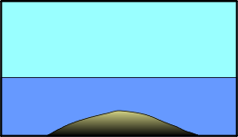
Key Concepts: Volcanic islands form over a hot spot
on the ocean floor. Islands form and erode in eight stages
(1)
deep submarine stage
(2)
shallow submarine stage
(3) subaerial shield-building stage
(4) post-caldera stage
(5) erosional stage
(6) stage of reef growth
(7) stage of post-erosional eruptions, and
(8) atoll stage. Refer to the website for an animation of
this process.
The
relative age of an island or atoll can be determined based
on its state of growth or erosion. The Hawaiian archipelago
rides on the Pacific tectonic plate that is moving in a northwesterly
direction. The oldest islands in the archipelago are located
northwest of the main islands, and the youngest island (Lo'ihi)
is forming under the ocean off the eastern coast of the island
of Hawai'i.
Objectives: Students will be able to:
1. Identify the eight life cycle stages of an island.
2. Identify the stage of an island based on given criteria.
3. Demonstrate their understanding of the life cycle of an
island by illustrating the process and creating their own
names for the eight stages.
4. Identify the stage of an island based on photographs.
Time: 30 - 45 minutes
Materials: NWHI website, photographs of selected islands
in the Hawaiian archipelago.
Preparation and Procedure: Teachers should explain
the concept of plate
tectonics and hot spots to show how volcanoes are formed
over a single spot in the ocean floor, become islands, and
drifted toward the northwest. A map
that shows the submerged ridge that connects the islands and
atolls in the archipelago can be used to illustrate this
concept. The cross-section of the Hawaiian islands in the
NWHI map can also be used to stress this point. Aerial
photographs of the NWHI can be used to illustrate the
different stages of growth and erosion of an island. These
photographs can be downloaded from the website. Teachers should
begin by showing photographs
of eruptions on the island of Hawai'i as an example of
an island in the shield-building stage.
Created
by the Bishop Museum, 2000.
 Talk About It! Talk About It!
The formation of archipelagos
Asked by jake on Mar 25, 2004.
how are archipelago islands formed
Answered by Paulo from UH on Mar 30, 2004.
An archipelago is a group of islands that normally share a common geological history. Most of them involve a volcanic origin, such as the Hawaiian Islands. When magma (underground lava) flows out of the sea floor, it slowly grows upwards, and sometimes after millions of years it can reach the surface forming an island. The place where magma flows out on the sea floor is known as a hot spot, and its location relative to the center of the Earth tends to be fairly stable. But the crust that makes the actual sea and land surface, known as a tectonic plate, moves over this hot spot. This movement is very slow, but over millions of years the hot spot position over a tectonic plate changes. The flow of magma can be sporadic, leading to periods of intense activity and periods of rest. This can often lead to the formation of many islands (periods of activity) separated by ocean (marking the periods of rest), eventually forming an archipelago. |