Northwestern Hawiian Islands Multi-Agency Education Project Banner

Latest News
Expeditions
For Teachers
For Keiki (Kids)
Discussions
About the Area
Residents
Photo Images
Video Images
Maps and Satellite Images
More Info
Partners

You are here: /main/research/NOWRAMP 2002/ship logs/9_11_02/

NOWRAMP 2002

Ship Logs
Journals
Interviews
Features

9/11/02

Position:
Latitude: 23° 46.188' N

Longitude: 166° 14.079 W
Area Name: French Frigate Shoals

Weather:
Barometer:
1019.2 mb 30.10" steady
Winds: 25-30 Knots
Description: Fair.
Forecast: Trades 15-25 Knots, Seas 6-8'

Sea Conditions:
Waves:
2-4 ft. inside atoll
Current: Mild, 1 knot west
Sea: Choppy. 40' visibility

Daily Vessel Plan:
Scheduled Activities:
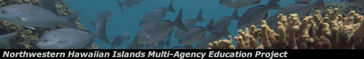
REA (Rapid Ecological Assessment) Teams:
2 site surveys per team inside the lagoon, habitats include reticulated reef, sandy flats and inner edge of emergent reef.

Coral Coring: 1st core taken.

Maritime Archaeology: Checked possible wreck sites.

Satellite Imaging: Groung truthing.


<<Journals Home


Click here to ask question about the topic of this page!Ask About It!


La Perouse Pinnacle Sunset.


Home | News | About | Expeditions | Photos | Video | Maps
Discussions | Partners | Teachers | Keiki | More Info | Search
Contact Us | Privacy Policy
This site is hosted by the
Laboratory for Interactive Learning Technologies
at the University of Hawai`i