October 5th : The Elder Atoll
Written By Dan Suthers October 5-6, 2004
Fighting off a cold virus, I went to bed "early" (0100) last night and slept until 1100 today. More accurately, I was in bed until then, as the rollicking waves kept me awake until well after 0300 (and others as well). It seems to have worked: I feel functional.
After an overnight transit of about 56 nautical miles [1,5], we have arrived at Kure Atoll. Kure atoll is smaller than Pearl and Hermes, but just as beautiful with turquoise and green waters surrounded by the blue Pacific.
Why Is This The Last Atoll?
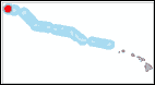 Kure is the northernmost of the Northwestern Hawaiian Islands, 1240 nautical miles from Honolulu [4]. If one continues up the Hawaiian Archipelago further northwest, one would find only sunken islands called seamounts. Why does Kure Atoll remain above sea level, while further northeast, Hancock, Mellish, Milwaukee, Kinmei, Jingu, Nintoku, Suiko, and Tenchi [5] are seamounts rather than islands? Some geological background is necessary.
The islands of the Hawaiian Archipelago are formed by volcanic activity: magma rises from within the earth, flows to the surface, and solidifies, piling up on top of the seabed floor until an island is formed. The ocean floor is moving northwest while the source of magma remains relatively stationary. Therefore, as the island building process repeats, a chain of islands forms, with the youngest island at the location of present volcanic activity (Volcano National Park), and the age of islands increasing towards northwest. We are visiting the elder "kupuna" islands, and Kure is the oldest (estimates in my references range from 30 to 60 million years [3,5]).
A mass of solidified magma large enough to emerge as an island is very heavy: its sheer weight causes the seabed and hence the island sitting on top of it to sink in a slow process called "subsidence." Also, erosion reduces the size of the island from above. When an island has eroded and subsided to sea level, it will continue to sink and become an underwater seamount unless something keeps it at the surface. This "something" is coral. As the island-turned-atoll sinks, coral grows on top of it, keeping it at sea level.
The rate of coral growth is affected (among other things) by water temperature. The Hawaiian island chain is being transported at a rate of 10cm/year to the northwest. As an atoll moves north, the water gets colder. Eventually it reaches a point where the rate of coral growth (slowed down by colder water) can no longer keep up with the rate of subsidence. Beyond this point, the atoll sinks. The latitude at which this happens (about 29 degrees north in this part of the world) is called the "Darwin Point", after Charles Darwin, who gave the first account of atoll formation. [2, 5]
The coral of Kure Atoll is the furthest from the equator of any coral in the world: the coral cannot maintain atolls north of here. Hence our voyage northwest must sadly end here, and we will be returning back down the island chain after three days of work at Kure. But let's enjoy the scenery before we leave.
Towboarding
According to plan, the Towboard Team picked me up during their midday "swapout" (their camera memory fills with images, which are uploaded to a laptop, and they also pick up air bottles). The towboard team is led by Brian Zgliczynski, who specializes in fish, and also includes Joe Laughlin (fish), Molly Timmers, and Casey Wilkinson (benthic habitat).
 They take turns being towed in pairs (one fish and one habitat person) while the other pair drives the launch and records GPS coordinates. We arranged for me to photograph the towboarders in operation during their afternoon shallow water tow, and I interviewed each pair of team members as they drove the boat for the other pair. More detail about towboard operations can be found in a feature article. Briefly, two divers are towed behind the boat as they hang on to the towboards, which contain various instruments and cameras as well as a data recording sheet. One towboarder surveys fish, and carries a video camera facing forward; another towboarder surveys benthic habitat, taking still photographs of the bottom at regular intervals. There is a device that records temperature and depth, and a telegraph system to signal to the boat operator, who records the GPS coordinates of the tow's start and end positions.
 Towboard operations are conducted all over the atolls, so this is a good boat to get on if you want a tour of the area. Today's focus was the interior of the atoll, so I saw its luminous waters, the waves breaking at the barrier reef, and beaches of Green Island (pictured). Brian swam under the dock at Green Island briefly to look for a fish specimen (none found), but we did not land on this recently quarantined island. Later we passed by the remains of a Navy helicopter that rolled off a sand dune into the surf when crew-members were trying to scoop glass ball souvenirs off of ever-changing Sand Island.
Our day ended with a fish-hunt: we found a reef dropping off from shallow water to the depths, which Brian and Joe searched for live specimens, using a stick to scare them out of their hiding places into a net (see also tomorrow's journal). Several fish were captured for our photographers.
Evening
Tonight's TOAD reveals yet more surprises: a monk seal investigating the device, and an area with many large anemone, with long filamentous tentacles extended in the current. David and Susan are photographing today's catch, while Kyle is on the back deck, preparing two Wave and Tide Recorders for deployment tomorrow.

[1] A nautical mile is one minute (1/60th of a degree) of latitude. It's about 15% longer than a "regular" statute mile.
[2] Gulko (1998)
[3] Harrison (1990)
[4] Maragos & Gulko (2002)
[5] Rauzon (2001)


