|
You
are here: /main/research
expeditions/May 2005/Brooks Bank
Mapping
Brooks
Bank Mapping
by NWHI Mapping Team
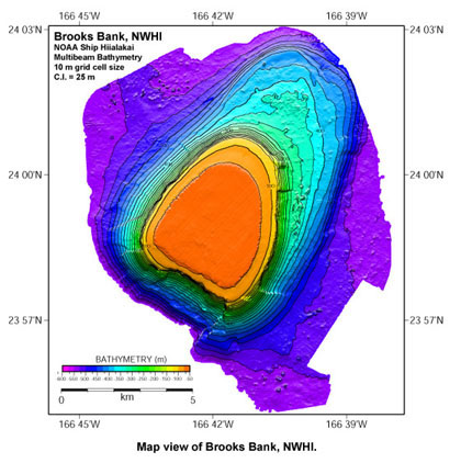
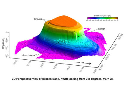
Brooks
Bank was recently mapped by the NOAA ship Hi`ialakai. The
high resolution seafloor topography data reveals the flat-topped
nature of many of the seamounts and atolls in the Northwestern
Hawaiian Islands (NWHI) archipelago. These seamounts formed
by erosion when their tops were near sea level. Brooks Bank
has two distinct terraces at -75 and -125 m illustrating the
affects of at least two distinct sea level stands on the Bank.
There is over 500 m of relief between the top of Brooks Bank
and the surrounding seafloor and large submarine canyons characterize
the steep slopes below the incised edges of the Bank top.
Blocks
of material at the base of the slopes are probably slumps
or landslide deposits similar to material mapped around the
Main Hawaiian Islands, believed to be deposited during catastrophic
landslide events. Information gained from images like these
give insight into the evolution of the Hawaiian Islands, provide
base layers for benthic habitat mapping, and aid in NWHI Coral
Reef Ecosystem Reserve boundary determination. NOAA is currently
undertaking the enormous task of mapping the NWHI Coral Reef
Ecosystem Reserve, the largest offshore protected area in
the United States.
|