|
You
are here: /main/research
expeditions/ 2005 RAMP/8_27_05
On Our Way
8/27/05,
On Our Way
by
Kelly Gleason, Maritime Archaeology

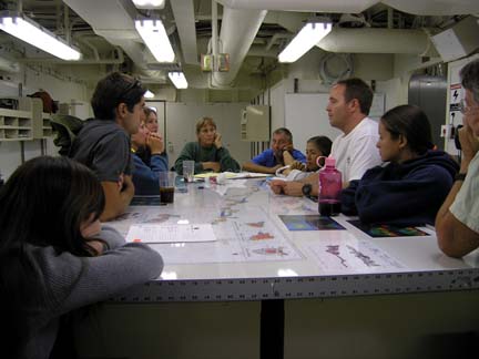
Planning meeting for the REA (Rapid Ecological Assessment)
dive team in the Hi`ialakai's dry lab. L to R: Jen Salerno,
Kosta
Stamoulis, Cheryl Squair, Darla White, Greta Aeby, Rich Osada,
Paula Ayotte, Scott Godwin, Holly Bolick, Fenny Cox.
Packing bags, running errands, calling friends… getting
ready for a five week cruise takes a lot of preparation. For
me, these tasks which can normally take weeks were condensed
into a twenty four hour period from the time when Chief Scientist
Randy Kosaki walked into my office yesterday morning and asked
me if I wanted to participate in this Rapid Assessment and
Monitoring Program (RAMP) cruise to the Northwestern Hawaiian
Islands (NWHI). The decision to come aboard was an easy one
for me. An opportunity to visit the NWHI, no matter how short
the notice is, is not a chance to be taken lightly. This archipelago
is a part of the world where new discoveries are a daily occurrence,
and animals and creatures are still unfamiliar with human
presence. The risks of my absence from my office in Honolulu
were far outweighed by the benefits of visiting the pristine
atolls of the NWHI, and in less than 24 hours I had packed
my gear, made my calls, and paid my bills. For the next five
weeks I will be working alongside a group of nine Rapid Ecological
Assessment (REA) divers and six collecting and tagging team
members from the Northwestern Hawaiian Islands Coral Reef
Ecosystem Reserve (NWHICRER) , State of Hawaii Department
of Land and Natural Resources (DLNR), the Hawaii Institute
of Biology (HIMB), the University of Hawaii (UH), and the
Bernice P. Bishop Museum (BPBM), watching and learning from
their work so the importance of what they do reaches an audience
far beyond the atolls in this part of the Pacific.
We
began our transit to our first stop at French Frigate Shoals
late this afternoon. The time before arriving at the first
monitoring site gives the scientists an opportunity to settle
in, go over dive procedures, and begin discussing field work
strategy with team other team members. Shortly after the ship
was underway, laptops came out, data sheets began circulating,
and field gear is being tested and set up. The NOAA Ship Hi’ialakai
has hosted many different scientific and educational missions
this season. This particular cruise is an important annual
assessment, monitoring, and mapping mission that will take
place at Nihoa Island, Mokumanamana (Necker Island), French
Frigate Shoals, Gardner Pinnacles, Maro Reef, Laysan Island,
Lisianski Island/Neva Shoals, Pearl and Hermes Atoll, Kure
Atoll, and Midway Atoll over the course of thirty five days.
Annual monitoring at these fixed locations began in 2003,
and revisiting the same sites allows managers the ability
to understand abundance and distributions of reef fish, invertebrates,
coral and algae. The scientists who have gathered for this
mission all have projects in their respective fields of expertise
that keep them busy. However, for the next five weeks, the
primary focus of the group of scientists who came together
for this cruise is to combine their expertise for the purposes
of identifying and quantifying coral, algae, invertebrates
and fish at the specific monitoring sites spread out across
the expanses of the NWHI. Other scientists will also deploy
and retrieve receivers to detect sharks and large jacks in
locations at French Frigate Shoals, Maro Reef, Pearl and Hermes
Atoll, Midway Atoll, and Kure Atoll. Some of the scientists
participating in this cruise were also involved in the May/June
2005 cruise to the NWHI, and their work over the next couple
of weeks will follow up on research that they conducted in
the spring. Scientists are preparing for long days underwater
and in the sun, but everyone is excited for what they are
about to become a part of.
Return
to Expedition main page
|